


南加州近期火災的煙霧從衛星影像顯示令人震撼😨
火積雲是在極端高溫上升到大氣層時形成的,通常源於野火或火山爆發。強烈的熱量使地面附近的空氣迅速上升,隨著上升,空氣逐漸冷卻並凝結成水滴,最終形成高聳的積雲。
在野火或火山爆發的情況下,火積雲通常包含大量的灰燼、煙塵和其他顆粒,這些物質與水蒸氣一起被捲入空中,使雲層呈現出黑暗、骯髒的外觀。
Line 火災於 9 月 5 日在 Highland 附近開始,截至 9 月 11 日當地時間上午 7 點左右,已燃燒 34,659 英畝,僅控制了約 14%。超過 65,600 棟建築面臨火災威脅,數個社區已發布了疏散命令和警告!!
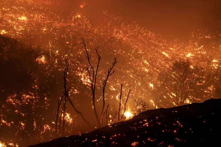
The Line Fire slows for the evening after a sudden a late-season monsoon rainstorm temporarily halted its 4,000-foot elevation climb up to the edge of mountain communities on September 7, 2024 near Running Springs, California. Three of California’s most recently ignited wildfires produced smoke plumes visible from space earlier this week. Getty
資訊來源: ABC7
©本報導所含文字屬 WaCow Media 版權所有,歡迎非商業讀者轉載且註明出處。如有盜文/盜圖者竄改盜用,一經發現,將訴諸法律途徑。
.
Comments
Category: Default, Featured, full-image, News 新聞, Whats Hot, 資Information


